Category: Navigation

GPS Units Pro’s VS Con’s

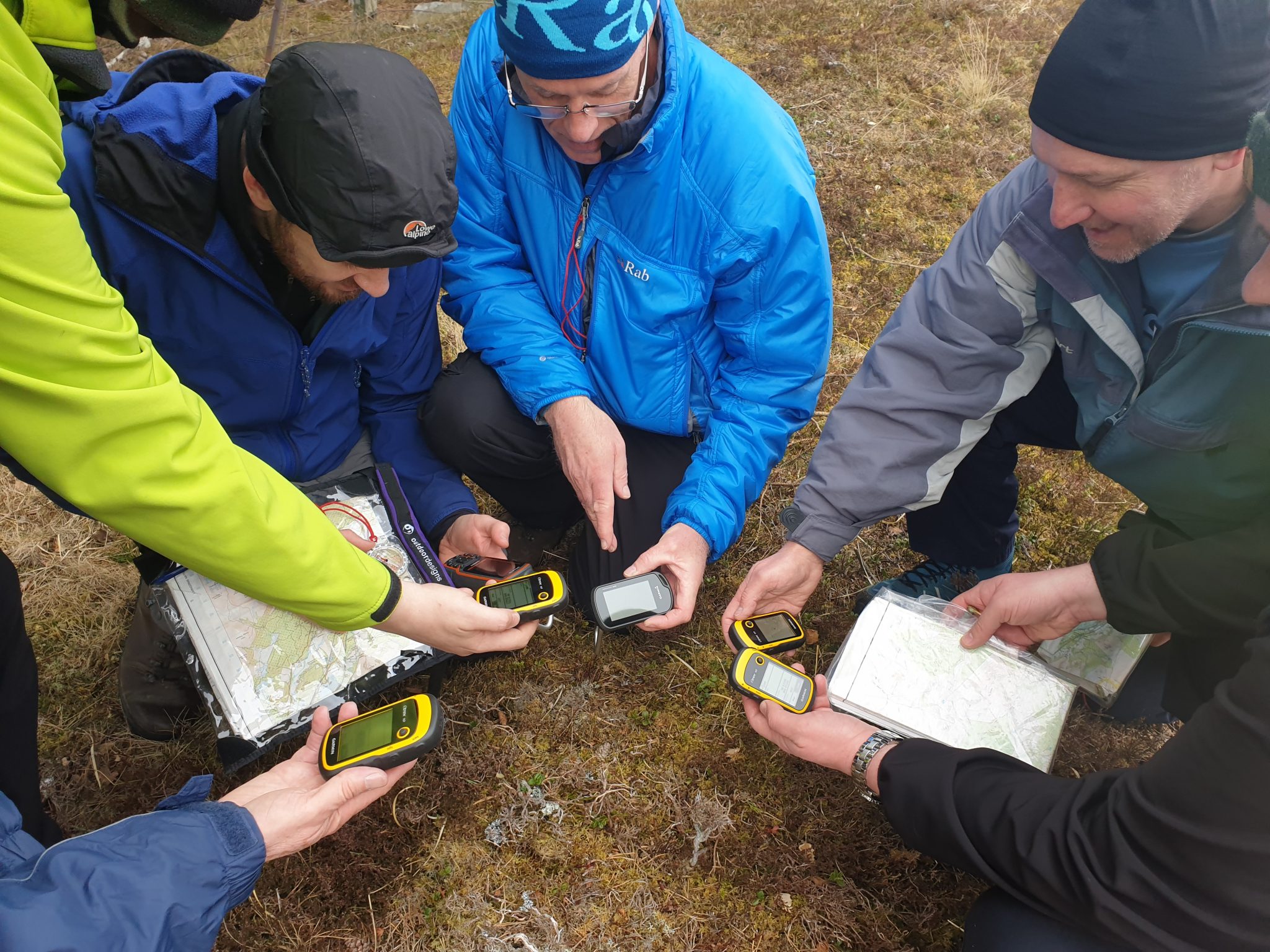
A big thanks to Garmin UK for sending us GPS units for clients to trial this year on our courses. Where it is undeniable that GPS have their place as a navigational tool, are we perhaps getting a bit too reliant on the technology?


Pros

1. Fast and effective way of fixing your position
Let’s face it, we’re all fallible and even the most experienced get “geographically embarrassed” at times. Forget about expensive scrolling map versions of the GPS a good starter from Garmin is the eTrex 10 or 20x and pretty much all you’ll ever need.

2. Essential when visiting areas where mapping is poor
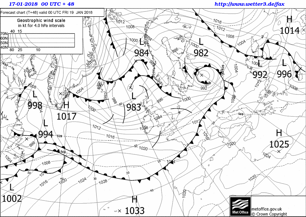
In places such as central Africa, desert, flat ice or featureless expanses you’ll need a GPS, to get grid and/or long/lat to relate back to the map, otherwise you’ll need to work on timings/paces over long distances which are never very accurate.

3. Psychologically helpful as a backup for leaders/beginners operating in poor weather conditions.
In whiteout conditions or low cloud, it’s always a calming effect on the leader of a group that they have a back up to map and compass. For the price and weight of an eTrex there’s no excuse not to carry a GPS if you are a leader, instructor or guide.

4. Functionality on modern units such as Garmin tends to be “intuitive”.
Gone are the days where GPS units where difficult to use, now with just a few clicks you can fix your location quickly and efficiently, a bonus if you’re wearing thick gloves.

5. Superb for tracking physical fitness levels and progress
Modern wrist GPS’s are great if you’re trying to get the most physically. You can track, contrast and compare your progress when in the outdoors.

Cons

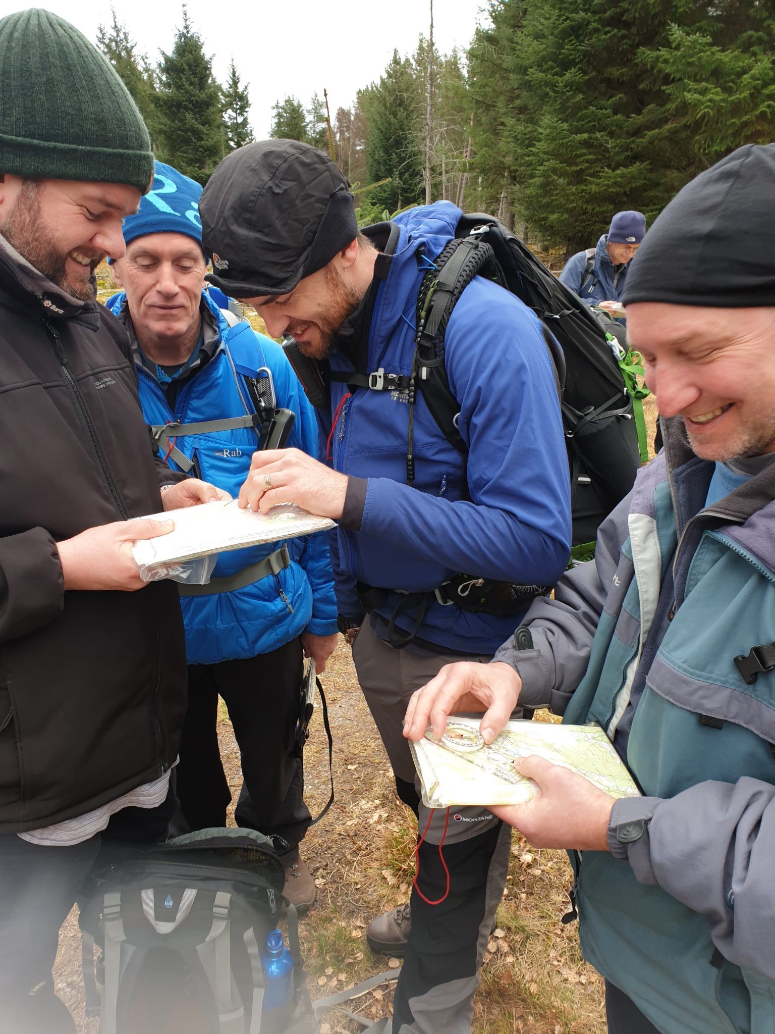
1. If you can’t use a map and compass you can’t use a GPS…….Safely.
We see a lot of folk using a scrolling map GPS more and more, this however tends to lead to over reliance on a GPS. 9 out of 10 folk won’t be able to fix a 6 figure Grid reference on them either, which means if they have a GPS malfunction or it runs out of battery’s they cannot relate a Grid reference back to the map.
A GPS needs to be set to the mapping system of the country you are in as well. If you are in the UK you may well have your GPS set to Long/Lat but carry a OS map that is British Grid. Learn to take a 6 figure grid reference and use a map and compass as a primary navigation aid. Use a GPS as a back up unit.

2. Limited by battery life
One of the Cardinal sins in outdoors folk these day is using their phone as GPS. This annihilates your battery and will mean you can’t use your phone to make emergency calls or SARLOC if SAR are looking for you….DON’T DO IT.
Modern hand held units are rechargeable, however ALWAYS keep spare batteries with you. It’s also worth bearing in mind that if you’re navigating in cold weather, your batteries will last 2/3rds the time, meaning if you have a GPS unit running all day, you may have to change batteries during the trip.

3. Electronic equipment is prone to failure
As well as modern units are made these days, it’s really not worth putting your life in the hands of some circuitry…….Map and Compass.

4. Using “waypoints” will take you in a straight line
If planning your trip purely by marked waypoints, always remember it will take you in a straight line. Be it a cliff, river, scree slope or avalanche prone slope…..that’s where your GPS will take you!

5. It takes the fun out of Navigation
Navigating well in a wilderness environment is all about freedom, there’s not much freedom following an arrow on your screen. Navigating in poor vision and getting it right is a buzz! We’ve got loads of navigation courses in our mountain/exped courses and we also hammer navigation into clients on our Survival courses, it’s one of the most important outdoor skills you could possess.

SumoSurvival #118 Weather forecasting

Thanks to Si and our friends Sumo Survival for having us on episode 118 of their podcast. Neil gobs off for half an hour on #synoptics #weather fronts and #cloud formations!

http://www.sumosurvival.com/episode-118-weather-forecastin…/

For those of you that are looking for the Synoptic resource you can find the link here – https://www.backcountrysurvival.co.uk/2018/04/17/synoptic-resource/

Natural Navigation; Shadow Sticks

You Should never substitute good map and compass work for natural navigation, Natural nav should be used to supplement a comprehensive knowledge of modern techniques.  The use of using naturally occurring  phenomenon also gives us a greater understanding of how our planet works in relation to the sun, stars, winds and plant life.

One of the more tricky natural nav techniques individuals have a hard time getting their heads around are shadow sticks.  In this short Blog we’ll go through the basics.

As we all know (hopefully) the sun rises in the East and sets in the West. At 12 o’clock mid day the sun is at it’s highest in the sky or “Zenith”. This means at 12 noon, the sun is directly in the South in the Northern hemisphere, and North in the southern hemisphere.

NOTE Please adjust for BST, or whatever light saving time used for you’re country. After the last Sunday in March, the clocks go forward, meaning the sun is at it’s zenith at 1300.

So if we know that the sun rises in the East and sets in the west, we can be sure that the sun is in a constant transition from East to West throughout the day. Using a straight stick, ideally waist height, drive this into the ground.  Where the shadow of the top of the stick falls is you’re WEST marker.

NOTE, this first marker as it is, is not pointing to “West”, all we know is that if the the sun is in the East it must be throwing the sticks shadow in a more westerly direction, as shadows form on the opposite side of a light source.

For this method to be accurate we need to leave the shadow stick at least 15-20mins, the longer you leave the shadow stick, the more accurate it will be.

After 15-20 mins the sun has traveled further to the west, and is thus throwing it’s shadow in a more easterly direction than before NOTE This last shadow is not pointing East, but is in a more easterly direction relative to it’s position 15-20 minutes ago.


The final stick you place in the ground is your EAST marker, you can place a long stick between the two WEST and EAST markers. Then with a second stick, bisect the West/East line to give you your N/E pointers, remembering the old acronym Never Eat Shredded Wheat, will help you with this!

Weather

WEATHER


In this article we will be having a look at weather forecasting, along with short term forecasting out on the ground using cloud formations and wind directions.

The two best weather forecasting resources in our opinion are;


Isobars – are lines on a weather map joining together places of equal atmospheric pressure. At sea level the average hPa (Hectopascals) is 1013. Everything over this number is a High pressure, and everything below is a Low pressure. On the map the isobar marked 1022 represents an area of high pressure, while the isobar marked 995 represents an area of low pressure.  In areas of high pressure we would expect to observe fairly clear skies. In areas of low pressure the air condenses to form clouds, and skies are usually overcast.

Anti-Cyclonic – High pressure Isobars rotate clock-wise, thus where an isobar of high pressure meets your position on the map, the wind direction will be running in line with the isobar. In this example the wind direction in Northern Ireland will be coming from the NW. Note In the southern hemisphere the direction of is the opposite i.e winds are carried round a high in an anti-clockwise direction.

Cyclonic – Low pressure bars rotate anti-clockwise. In the above example the wind direction in Britain will be coming from the SE.

Cold fronts – are usually associated with depressions. A cold front is the transition zone where a cold air mass is replacing the warmer air mass. The cold air is following the warm air and gradually moves underneath the warmer air. When the warm air is pushed upwards it will rain heavily. More rain will often fall in the few minutes the cold front passes than it will during the whole passage of a warm front. As the cold front passes, the clouds roll by and the air temperature is cooler.

Cold fronts are shown on synoptic charts by a solid line with triangles along the front pointing towards the warmer air and in the direction of movement. On coloured weather maps, a cold front is drawn with a solid blue line with blue triangles.

Warm fronts– are formed when warm air rises over a mass of cold air. As the air lifts into regions of lower pressure, it expands, cools and condenses the water vapour as wide, flat sheets of cloud.

Warm fronts are shown on synoptic charts by a solid line with semicircles pointing towards the colder air and in the direction of movement. On coloured weather maps, a warm front is drawn with a solid red line with red semicircles.

Occluded fronts – occur at the point where a cold front takes over a warm front or the other way around. If a cold front undercuts a warm front it is known as a cold occlusion and if the cold front rises over the warm front it is called a warm occlusion. Occluded fronts bring changeable weather conditions.

On a synoptic chart, occluded fronts are represented by semicircles and triangles positioned next to each other. The triangles are in blue and the semicircles are in red, or both are purple (mixing both red and blue colours together).

Depressions– are areas of low atmospheric pressure which produce cloudy, rainy and windy weather. These low-pressure systems often begin in the Atlantic, moving eastwards towards the UK. They are responsible for the UK’s changeable weather.

Anticyclones – are the opposite of depressions – they are an area of high atmospheric pressure where the air is sinking.

Trough- A trough on a weather map is an elongated area of relatively low pressure. Troughs bring cloudy and rainy weather and are represented by a hash mark.


CLOUDS

Clouds can also help you to read approaching weather, there are 4 types of clouds, high clouds, medium clouds, low clouds and clouds with vertical growth. and within these four types are 3 main shapes;

Cumulus  – Greek for a heap or pile

Stratus – Greek for long sheet or layer

Nimbus – Rain like

High clouds 16-50,000 ft

Fair weather clouds are white and high in the sky it should be noted that these clouds rarely block sunlight. High clouds include;

Cirrus– is made from ice crystals as the cloud forms at temperatures well below freezing. Cirrus is greek for “hair-like” and shows that the weather will be fair.

Cirrus

Cirrostratus – Appears as a hazy sheet. Precipitation is likely to occur within 24 hours

Cirrostratus


Cirrocumulus – Neatly aligned small clouds or Mackerel sky. Fair weather.


Medium clouds – 6.5-16,000 ft

Thick layers of medium-layer clouds give heavy persistent rain, especially if the clouds are dark and grey.

This includes;

Altocumulus– they signify fairly deep instability.

Altocumulus

Lenticular – Lenticular clouds are formed by high winds, and typically align with the direction of the wind.

Altostratus– Grey/Blue clouds, covering most of the sky. usually indicates the approach of a warm front.

Altostratus


Low clouds – Below 6500 ft

Low clouds can indicate whether rain will fall in short down pours or persistently.

Stratus– dense grey cloud that covers the sky in a sheet, rain can fall continuously and for long periods of time.


Nimbostratus– can cause moderate to heavy persistent rain.

Nimbostratus

Stratocumulus– covers the sky in an irregular sheet that can be either grey or white in colour. These can lead to drizzle or snow.

Stratocumulus

Clouds with vertical growth

Cumulonimbus

High cloud . Cumulonimbus

Cumulonimbus is associated with thunderstorms and heavy rain. Anvil shaped at the top, the anvil points into the direction of the wind/front

Never underestimate the weather and ensure that you make it a priority that you check the forecast before you leave for your trip. Cumulus– often develops on bright sunny days in slightly unstable air masses. As long as these billowing, puffy clouds keep their form, they, along with blue sky, indicate fine weather.

Wind Direction

As discussed above, reading the isobars on the Synoptic can give you the wind direction, but which weather systems will be brought in in the UK by differing wind directions?

Northerly winds

Also known as a Arctic Maritime, given the fact that a Northerly brings cold air from the Arctic and travels over the North sea.  Northerly’s tend to bring cold, precipitous (wet or snow in winter) weather.

North Westerly

Also know as a Polar maritime coming from Greenland/Arctic sea.  NW winds will bring cold showery weather.

Westerly

Also know as a Returning Polar Maritime. Winds coming from the east will bring unstable weather systems.  Typical weather to be expected is clear weather which quickly turns rainy, then turning to clear sky’s  again.

South West

Also known as Tropical Maritime, tends to bring wet and cloudy mild weather. winds come from the Atlantic ocean.

South East

Also Known as Tropical Continental, winds coming from the SE brings hot, dry air which blows in from N. Africa.

Easterly

Also Known as Polar Continental. during the summer this brings warm dry air from Europe. During the winter Easterly’s will bring snow and cold air from Russia.